Printed & framed in your country·Ships in 2–4 business days·30-day free replacement — nothing to send back·Restored from the archive's own scanFree US shipping, no minimum
Scenes are drawn to scale: the sofa is 84 in wide, the desk 60 in, the door 80 in tall. Switch sizes above to compare.
Step 1 — set the scale. Drag the slider until the gold bar on the photo is the height of a standard doorway (80 in / 203 cm). Every size you pick is then drawn true to life.
Step 2 — drag the print to where it would hang, and change size or frame above to compare.
Framed Topographic Maps
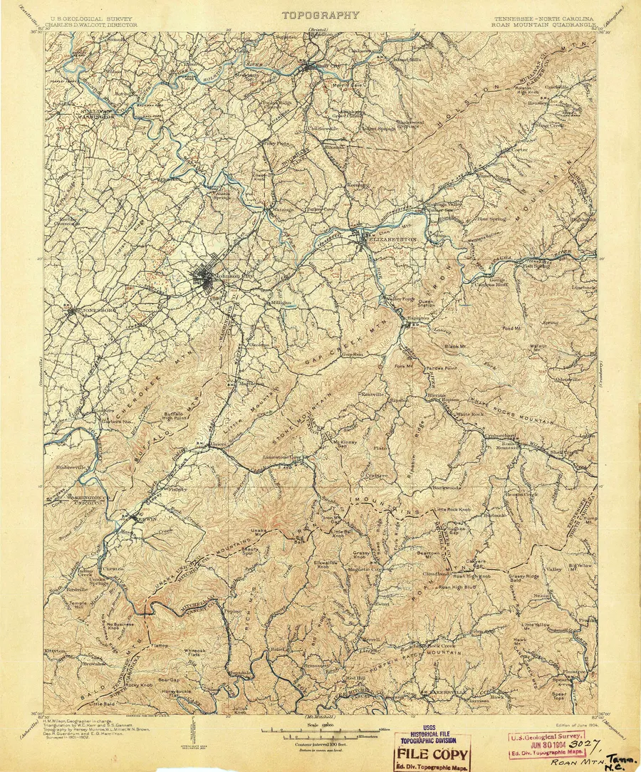
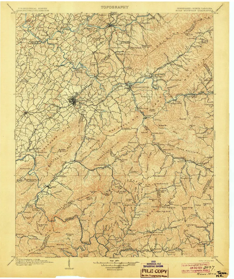
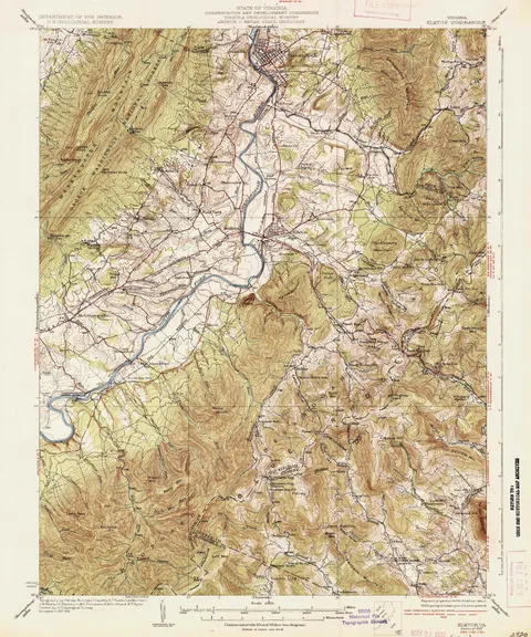
Roan Mountain Topographic Map, 1904
Roan Mountain, Tennessee – North Carolina quadrangle — US Geological Survey, 1:125,000
From the USGS Historical Topographic Map Collection (HTMC) via The National Map S3 bucket · 1904
$212Charged in USD at checkout; local currency shown for reference.
Source scan:USGS Historical Topographic Map Collection (HTMC) via The National Map S3 bucket. Rights statement of the archive: “USGS-authored or produced data and information are considered to be in the U.S. Public Domain. While the content of most USGS websites is in the U.S. Public Domain, not all information, illustrations, or photographs on our site are. ... When using information from USGS information products, publications, or websites, we ask that proper credit be given.” Original map: US Geological Survey, 1904, Roan Mountain, Tennessee – North Carolina quadrangle, 1:125,000 — sheet dimensions not stated in the S3 listing. Verified 2026-09-19.
This product is a new archival print made from a restored scan of that map. It is not an original antique and is not sold as one.
Which finish
The same print, five ways
Prices are for the size you have chosen above — change the size and these change with it. Tap one to choose it.
Framed and canvas arrive ready to hang. Paper arrives as the print alone — if you are framing it yourself, measure the print size, not the framed size quoted in the picker. Every finish is the same restored file at the same resolution: the finish changes what the print is mounted on, never the image.
The story of this map
Roan Mountain carries the longest stretch of grassy bald on the whole Appalachian chain, and hikers who have walked it in June, with rhododendron on the summit and nothing but grass and sky along the ridge, tend to remember it above everything else on the trail. This sheet maps it in 1904.
The Survey drew the Roan Mountain quadrangle at 1:125,000, and at that scale the balds appear as what they are: broad rounded summits strung along a single high line, with the land dropping hard into the Doe and Nolichucky valleys on either side. Carvers Gap sits at the saddle where the state line crosses, and Hump Mountain rises to the north-east.
Nothing here is a trail map. The Appalachian Trail would not be built across these balds for another quarter century, and the routes shown are wagon roads and county lines. That is much of the appeal: this is the ground as the surveyors found it, before the path.
We print it as a restored reproduction in our Framed Topographic Maps collection.
Before and after
Left: the archive scan exactly as published. Right: the file that goes to the printer.
Restoration notes
Scanner margins squared up, colour cast and levels balanced while keeping the warm tone of the paper, dust and specks removed, gentle sharpening. No contour, name or symbol is redrawn, and nothing is added that the surveyors did not print.
About this particular sheet. These sheets are scans of the Survey's own file copies. Small archive stamps, pencilled accession numbers and, on older sheets, the creases of having been folded, sit in the paper margins outside the map itself. They are part of the sheet's history and we print them as they are rather than paint them out. On this sheet the file-copy stamp in the lower margin is larger and printed in red, and there is a pencilled note beside it.
Every print carries its archive credit on the packing slip. Paper tone and small imperfections of the original are kept on purpose; nothing is redrawn.
Complete the wall
Add a second print and take 10% off the cheaper framed one
Priced at whatever size and finish you have chosen above, so the pair total is the real one. Change the size and these change with it.
The 10% comes off the cheaper framed print and is applied at checkout. Paper and canvas prints do not qualify on their own — the discount needs two framed prints in the cart.
From people who bought it
Every review here is from a verified order — the link is signed and sent 21 days after delivery, so nobody can review a print they did not buy. We read them before they go up and we do not edit them. We send a 10% code for leaving one, whatever it says: the code is never conditional on a rating, and we publish criticism. We hold a review back only if it is abusive, defamatory, off-topic or an advertisement, and we tell the writer why. The rules are here.
Informational purposes only, no warranties, not professional advice. All products are new archival prints made from restored scans of historical maps held by public archives; they are not original antiques. Colours vary by screen and by paper.
We use cookies for analytics and to measure our ads. No cookies are set for these until you agree. Privacy