5 min read · September 16, 2026
How to read the contour lines on a topographic map
Contours are not decoration and they are not paths. Once you can read spacing, shape and the V rule, a topographic sheet stops being a pattern and becomes a landscape you can walk in your head.
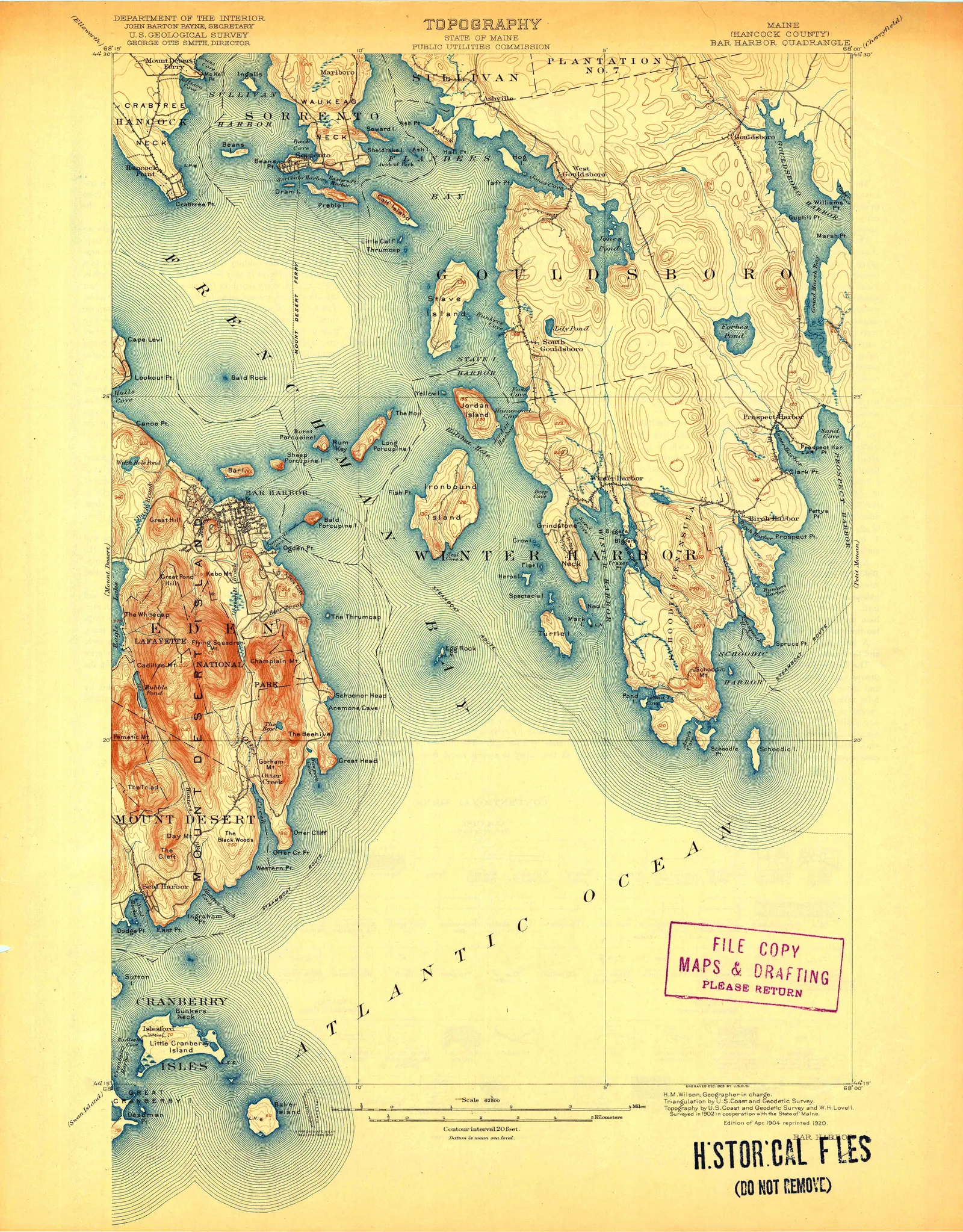
A topographic map looks like a pattern until you know one rule, and then it looks like a place. The rule is this: every line joins points of equal height. Walk along a contour and you neither climb nor descend. That is all a contour is.
Everything else follows from it.
Four things the lines tell you immediately
Spacing is steepness. Lines crowded together mean height gained over a short horizontal distance — a cliff or a steep face. Lines far apart mean a gentle slope or a flat. You can identify the hardest part of a climb on a sheet without reading a single number.
The contour interval is in the margin. Usually 10, 20, 40 or 80 feet on older USGS sheets, depending on the terrain. Every fifth line is drawn heavier and labelled — the index contour. Find one, count from it.
Closed loops are summits or hollows. A ring inside a ring inside a ring is a hill, and the smallest ring is the top. A depression is drawn the same way but with small tick marks — hachures — pointing inward, which is the only way to tell a crater from a peak on paper.
Vs point upstream. Where a contour crosses a valley it bends into a V, and the V points uphill, towards the head of the valley. Where it crosses a ridge it bends into a rounded U pointing downhill. This is the single most useful thing on the list: it lets you find every watercourse on a sheet even where no blue line is printed, because water runs down the middle of the V.
Two contours never cross. If they appear to, it is an overhang or a vertical face, and the surveyor will have drawn it differently.
Why the old sheets look better than the new ones
The USGS has mapped the United States at 1:24,000 and other scales since 1884, and has scanned its entire historical archive.
The early sheets — roughly 1890 to 1950 — were drawn and engraved by hand, and the difference shows. The lettering is placed by eye, curved along rivers and ridges. Contours were inked with a pen, so the line weight varies with the draughtsman’s hand. Water was often printed in a soft blue-green and relief sometimes given a hill-shade. They were made by people who had walked the ground with a plane table.
Post-war sheets are photogrammetric — compiled from aerial photography — and the later ones are digital. Far more accurate, far faster to produce, and much flatter to look at.
If you want a topographic map on a wall, the pre-1950 sheets are almost always the ones worth having, and it is a legibility argument as much as an aesthetic one: hand lettering is easier to read at a distance than a uniform machine face.
The panoramic cousins
Alongside the survey sheets sits a different tradition: the panoramic or bird’s-eye relief map, drawn in oblique perspective as though from a balloon. These are not measured in the same way — they are interpretations, sometimes with vertical exaggeration — but they show a landscape the way a person experiences it, which a contour sheet deliberately does not.
Our Mount Rainier panoramic map is that kind of sheet: the mountain drawn as a mountain, with its glaciers named. Hung beside a contour map of the same ground the pair make a point about what maps choose to tell you.
Public domain, and honestly printed
USGS topographic maps are works of the United States government and are not subject to copyright in the US. The full historical archive is digitised and published free, which is where ours come from; each product page names the sheet, the year and the archive record.
Ten sheets are in the topographic maps collection. If you want a specific quadrangle — the valley you hike, the mountain you climbed, the county you grew up in — the custom request form will usually find it within a few days. The archive covers essentially the whole country, and the limit is nearly always scan resolution rather than availability.
Sources
Where this came from
- USGS — topographic map symbols
- USGS Historical Topographic Map Explorer
- Library of Congress — Geography and Map Division
Corrections are welcome and we publish them — info@antiquemapprints.com. Nothing here is generated from a template; if something is wrong it is our mistake, not a machine's.


